
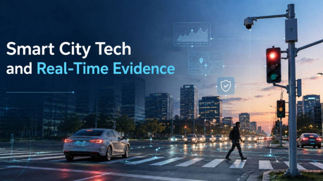
Road safety used to depend on what investigators could prove after a crash. Smart city technology is changing that by recording what the road was doing before impact.
Connected signals, roadside sensors, traffic cameras, radar, LiDAR, emergency dispatch systems, and vehicle-generated data are turning ordinary streets into live evidence networks. That matters because the most useful safety data is often created before the collision, not after it.
Road Safety Is Becoming a Data Problem, Not Just a Design Problem
Modern traffic deaths are not happening because cities lack basic crash records. They are happening because traditional records arrive too late.
Globally, road crashes still kill about 1.19 million people each year. In the United States, early estimates show 39,345 traffic deaths in 2024, even after a national decline from the previous year. Pedestrian risk remains especially high, with more than 7,000 people walking killed on U.S. roads in 2024.
Those numbers show the limit of old safety systems. A crash report can identify where the impact occurred, but it often cannot show the full chain of risk that led to it. It may not capture the driver who braked hard at the same spot ten minutes earlier, the pedestrian who stepped back from a turning vehicle, the signal phase that created a short crossing window, or the speed pattern that made a crash more severe.
Smart city tech adds that missing layer. It turns roads from passive infrastructure into active data systems.
The Old Evidence Trail Was Too Thin
For years, road safety evidence came from a familiar set of materials: police reports, witness statements, vehicle damage, skid marks, photos, insurance records, and sometimes surveillance footage. These are still important, but they are incomplete.
They usually describe the crash event, not the road environment that produced it.
A police report may state that a driver failed to yield. But a smart intersection can show whether that turn has produced repeated pedestrian conflicts for weeks. A crash photo may show a damaged crosswalk sign. But lighting sensors and maintenance logs may show whether that crossing was poorly visible before the crash. A witness may remember that traffic was heavy. But signal and queue data can show exactly how congestion affected driver behavior.
That is the difference between evidence after the fact and evidence built into the street.
What Smart City Tech Actually Captures
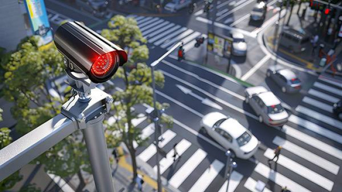
Smart road systems collect more than traffic volume. The most useful systems capture movement, timing, visibility, speed, conflict, and response.
| Technology Layer | Data It Creates | Why It Matters |
| Adaptive traffic signals | Signal phase, queue length, timing changes, red-light entries | Shows whether timing or congestion contributed to risk |
| Computer vision cameras | Pedestrian movement, turning behavior, lane violations, near-misses | Captures conflicts that may never become crash reports |
| Radar and LiDAR | Speed, distance, object position, trajectory | Measures movement even when video context is limited |
| Connected vehicle data | Hard braking, acceleration, warnings, road condition alerts | Shows driver reaction patterns before crashes happen |
| Smart lighting and weather sensors | Visibility, rain, glare, darkness, pavement conditions | Adds environmental context to crash and near-miss patterns |
| Emergency response systems | Dispatch time, arrival time, location accuracy, road closure time | Shows how infrastructure affects post-crash survival |
The strongest evidence comes when these layers support one another. If speed sensors show high approach speeds, cameras show late braking, and signal data shows repeated red-light entries, the road is no longer just “busy.” It is producing measurable danger.
The Real Breakthrough Is Near-Miss Evidence
Near-misses used to vanish. A cyclist swerved. A pedestrian jumped back. A driver slammed the brakes. No one was hit, so no report existed. From the city’s point of view, the road looked safer than it really was.
Smart infrastructure changes that. Computer vision can detect close passes. Radar can record sudden deceleration. Signal systems can identify vehicles entering intersections late. Connected vehicles can report hard-braking clusters. Pedestrian sensors can show people waiting unusually long or abandoning a crossing.
This matters because serious crashes are rare compared with unsafe interactions. A dangerous intersection may produce hundreds of conflicts before one fatal crash appears in the official record. Waiting for crash history means waiting for harm. Near-miss evidence allows cities to intervene earlier.
A smart road safety system can now flag:
● A right-turn lane where vehicles repeatedly pass close to pedestrians.
● A school-zone crossing where drivers brake hard during pickup hours.
● A downtown intersection where cyclists are squeezed by delivery traffic.
● A high-speed corridor where nighttime speeds rise after congestion clears.
● A work zone where lane shifts create sudden braking before the merge.
This is road safety moving from a historical record to a warning system.
Intersections Are Becoming Evidence Hubs
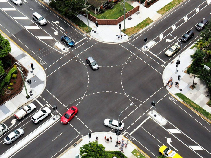
Intersections are where smart city road data becomes most valuable. They combine the highest number of movement conflicts in the smallest amount of space.
Drivers turn left across traffic. Vehicles turn right across crosswalks. Pedestrians judge signal time. Cyclists move through blind spots. Buses stop near corners. Delivery vehicles block visibility. Emergency vehicles interrupt normal flows. One weak design choice can multiply risk across several users at once.
Signalized intersections are especially important because they are not automatically safe just because they are controlled. They account for about one-third of all intersection fatalities, which shows that organized traffic movement can still produce severe conflict.
Smart city systems can examine an intersection at movement level, not just location level.
Instead of saying, “This intersection has a crash problem,” data can show:
● The eastbound left turn creates the most conflicts.
● Pedestrian exposure rises during the evening peak.
● Drivers enter the box after the red phase begins.
● Cyclists are not being detected early enough.
● The walk phase is too short for older pedestrians.
● Right-turn speeds are too high near the crosswalk.
● Queue spillback is pushing vehicles into unsafe decisions.
This allows cities to fix the exact risk instead of applying broad, expensive, and sometimes ineffective changes.
Smart Road Data Makes Speed Risk Harder to Ignore
Speed is one of the clearest examples of why real-time evidence matters.
A crash report may mark “speeding” as a factor, but smart infrastructure can show whether dangerous speed was normal at that location. That distinction is critical. A street where most drivers exceed the safe operating speed is not dealing with a few reckless individuals. It is dealing with a system that invites or permits dangerous behavior.
The injury difference between moderate and high impact speeds is severe. Pedestrian injury risk rises sharply as vehicle speed increases. A road operating near 40 mph creates a far more dangerous environment than one operating near 25 or 30 mph, especially where people walk, bike, wait for buses, or cross outside signalized intersections.
Smart sensors can show where posted limits and real speeds do not match. They can also reveal when the risk appears. A corridor may be tolerable during rush hour because congestion slows vehicles, then become dangerous at night when open lanes encourage faster driving.
That changes enforcement and design decisions. Cities can use real speed evidence to justify traffic calming, lane narrowing, signal timing changes, raised crossings, automated enforcement, or lower speed limits in targeted areas.
Crash Investigations Are Becoming More Technical
As road systems become more connected, crash investigations are becoming more data-heavy.
A serious collision may now involve traffic camera footage, signal phase records, red-light timing, vehicle event data, roadside sensor logs, weather data, lighting records, emergency dispatch timestamps, work-zone plans, maintenance history, and connected vehicle alerts.
That evidence can matter because crashes often involve more than one factor. A driver may have made a mistake, but the road environment may also have increased the likelihood or severity of the crash. Poor signal timing, blocked sightlines, defective lighting, confusing work-zone markings, bad drainage, or a known conflict pattern can all shape what happened.
In serious injury cases, a Knoxville Car Accident Lawyer may look at whether available road data, signal records, camera footage, or infrastructure conditions help explain how the crash unfolded and whether a preventable hazard existed before impact.
That placement is important because smart city evidence is not only about liability. It is about context. It can show whether the collision was an isolated event or part of a pattern the road had already been revealing.
The Most Useful Data Is Not Always the Most Advanced
Smart city road safety can sound futuristic, but the most valuable insights often come from practical data points.
A city does not need every intersection to become a fully automated AI environment. It needs the right data at the right locations, tied to decisions that can actually reduce harm.
The highest-value metrics usually include:
| Safety Metric | What It Reveals | Practical Use |
| Hard-braking clusters | Locations where drivers are reacting too late | Identify hidden conflict zones |
| Turning speed | Whether vehicles are taking corners too fast | Redesign curbs, add turn controls, adjust signal phases |
| Pedestrian exposure time | How long people remain in conflict with vehicles | Improve crossing time, refuge islands, and signal priority |
| Red-light entry | Late intersection movement | Support enforcement, retiming, and approach redesign |
| Nighttime conflict rate | Risk tied to visibility and speed | Prioritize lighting and speed management |
| Queue spillback | Congestion pushing vehicles into unsafe choices | Adjust signal coordination or lane use |
| Emergency response delay | Post-crash survival risk | Improve incident detection and routing |
The best safety data is not the data that looks impressive in a dashboard. It is the data that tells a city what to change next.
AI Is Turning Raw Traffic Data Into Patterns
Smart city systems produce too much data for manual review alone. A single busy intersection can generate thousands of daily vehicle movements, pedestrian crossings, signal phases, braking events, and object detections. AI helps turn that volume into usable patterns.
AI can classify road users, detect near-misses, estimate speed, identify lane violations, compare signal timing with movement behavior, and rank locations by predicted risk. It can also help cities distinguish between occasional random events and repeated safety patterns.
But AI should not become the final judge of road safety. It can detect that pedestrians frequently cross outside a marked crosswalk, but it may not understand why. The real issue could be a missing crossing, a badly placed transit stop, a signal that takes too long, or a sidewalk network that forces people into the road.
That is why the strongest systems combine AI detection with human engineering judgment, community input, and field review. Data should guide safety work, not replace it.
Smart City Evidence Can Expose Unequal Risk
Road safety risk is not evenly distributed. Some neighborhoods have better sidewalks, lighting, crossings, and traffic calming. Others have wide arterials, long crossing distances, poor transit access, and higher exposure to fast-moving traffic.
Smart city data can reveal those gaps, but only if deployment is fair.
If sensors are installed mostly in downtown business districts, airports, stadium corridors, and high-income neighborhoods, the data will overrepresent places already receiving attention. Older neighborhoods may remain undermeasured, even when their road conditions are more dangerous. This creates a serious problem: lack of data can be mistaken for lack of risk.
A road with few pedestrian crashes may be genuinely safe, or it may be so hostile that people avoid walking there. A corridor with low cyclist crash numbers may not be safe for cycling; it may simply discourage cycling altogether. A neighborhood with fewer complaints may have residents who do not expect the city to respond.
A user-first road safety program should measure exposure, not just crashes. It should look at schools, bus stops, senior housing, disability access, walking routes, lighting gaps, sidewalk condition, and emergency response times.
Smart infrastructure is most valuable when it finds risk that older systems missed.
Privacy Has to Be Built Into the System
Real-time road evidence can improve safety, but it also raises a reasonable public concern: how much should cities watch?
A city does not need to identify every driver, pedestrian, or cyclist to improve road safety. In most cases, useful safety analysis can be done with aggregated counts, anonymized trajectories, short retention periods, blurred video, and strict access controls.
The public should know what data is collected, why it is collected, how long it is stored, who can use it, and whether it can be used for enforcement or legal requests. Without those rules, even legitimate safety systems can begin to feel like surveillance systems.
The privacy standard should be simple: collect the minimum data needed to improve safety, protect identity wherever possible, and make the rules visible.
What Cities Should Do With Real-Time Evidence
The value of smart city road data depends on whether it changes the street.
A city that collects near-miss data but never changes signal timing has not improved safety. A city that identifies speeding patterns but never redesigns the road has only documented danger. A city that installs cameras but ignores sidewalk gaps has built a monitoring system, not a safety system.
Real-time evidence should lead to practical interventions:
● Add leading pedestrian intervals where turning conflicts are frequent.
● Retune signals where red-light entries cluster.
● Install protected left turns where crossing conflicts repeat.
● Improve lighting where night crashes or near-misses concentrate.
● Add curb extensions where crossing exposure is too long.
● Tighten turning radii where vehicles take corners at unsafe speeds.
● Redesign pickup and delivery zones where parked vehicles block sightlines.
● Use traffic calming where operating speeds exceed the road’s safety role.
● Improve emergency routing where crash response is delayed.
The technology is only useful if it shortens the distance between detecting risk and fixing it.
The Road Ahead
Smart city technology is turning road safety into real-time evidence because streets are no longer silent until a crash happens. They can now show speed patterns, near-misses, signal conflicts, visibility problems, pedestrian exposure, cyclist risk, and emergency response gaps as they develop.
That does not mean technology will solve road deaths by itself. Sensors cannot replace safer road design. AI cannot replace accountable planning. Cameras cannot substitute for lower speeds, better crossings, and streets built around human survival.
But smart infrastructure does change the standard of knowledge. When a road repeatedly produces dangerous conflicts, cities can no longer say they had no warning. The evidence is becoming visible earlier, richer in detail, and harder to ignore.
The next era of road safety will not be defined only by how well cities count crashes. It will be defined by how quickly they act on the warnings their roads are already sending.


Comments